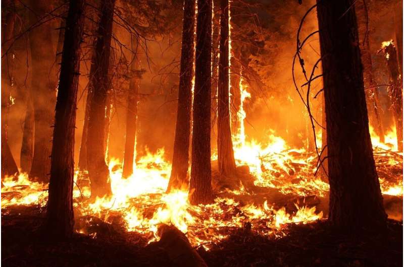
Less than 18 months after bone-dry conditions and Santa Ana winds fed two catastrophic wildfires through Altadena and Pacific Palisades, researchers from UC Davis are returning to the scarred landscapes with laser scanners and measured hope. The 2025 fires burned for 24 days, scorching 37,000 acres, destroying more than 16,000 structures, and claiming 31 lives—but they also sparked something unexpected: a scientific mission to understand how communities can rebuild better.
These fires were not isolated tragedies. They represent what Michael Kleeman, a UC Davis civil and environmental engineering professor, calls a national emergency. As Kleeman measured air quality across five occasions from March to September in both communities, it became clear that the impact stretched far beyond Southern California's borders. Yet from the rubble, a collaboration has emerged between UC Davis, UCLA, UC Agriculture and Natural Resources, the University of Florida, and the U.S. Forest Service—all working to document what burned, what survived, and what the future might hold.
Alessandro Ossola, an agronomist and associate professor who runs UC Davis's Urban Science Lab, has become the architect of this recovery narrative. Walking through the fire-ravaged communities weeks after the flames subsided, Ossola was struck by the scale. "It was bigger and broader than anything we'd ever imagined," he said. His focus: understanding which of the 220 different types of trees cataloged in public areas would recover, which were lost forever, and what that means for the character of these neighborhoods.
Using lidar—light detection and ranging equipment that creates 3D images of landscapes—the research team mapped 30 quadrants in Altadena and 15 in Pacific Palisades. They scanned the scarred terrain, then returned a year later to measure survival rates using both lidar surveys and on-the-ground tree inspections. The findings are sobering: Altadena lost 30 percent of its trees in public areas. Some losses came directly from the fire itself, others from well-intentioned but indiscriminate removal during cleanup, and still others from lack of care as displaced residents relocated.
But the research is yielding practical wisdom. Trained arborists, it turns out, should make removal decisions rather than emergency crews, because it often takes up to a year to determine whether a tree will actually survive. The damage itself tells a story: fires moved directionally, ignited by flames from houses, cars, and structures burning nearby. The fire rarely moved from trees to buildings—a finding that could reshape how communities think about defensible space and rebuilding standards.
Residents themselves are becoming partners in this recovery. Altadena Green, a grassroots organization established after the fire, connected with researchers to provide tree health assessments and advocated for hazardous tree removal waivers with the U.S. Army Corps of Engineers. For many residents whose homes were destroyed, those remaining trees represented continuity, memory, and identity. "There were so many people who the only thing left on their property were their trees, and they loved them, and they have a history," said Stephanie Landregan, director and co-founder of Altadena Green.
A dozen research papers and reports are being prepared, and Ossola's team continues their work with the kind of determined purpose that transforms tragedy into knowledge. As he puts it, "We need to learn from our data what went right and what went wrong so we can adapt." That commitment—to measure, to understand, and to rebuild smarter—offers something rare after catastrophe: a path forward built on science and community wisdom.