In the shadow of shrinking federal protections, Washington state scientists are turning to artificial intelligence to rescue the state's most elusive natural treasures—the "cryptic wetlands" that hide in plain sight across forests and semi-arid plains. Meghan Halabisky, a researcher at the University of Washington and chief scientist at Tealwaters, and Dan Miller, a geomorphologist at TerrainWorks, have spent years developing an AI tool designed to find the smaller, newer, and more vulnerable wetlands that traditional mapping methods miss—a race against time as both legal protections and climate patterns threaten to render these critical ecosystems invisible.
The urgency is real. In November 2025, the EPA clarified the definition of what qualifies as federally protected "Waters of the United States," narrowing protections to wetlands with surface water during the local "wet season" or those directly touching year-round flowing bodies of water. This change strips protections from tens of millions of acres. It's part of a larger erosion of wetlands protections—the 2023 Supreme Court decision in Sackett v. Environmental Protection Agency had already limited federal safeguards to wetlands with "continuous surface connections" to larger waters. Meanwhile, climate change is making the problem worse. In eastern Washington, scientists expect wetter, warmer winters and hotter, drier summers, meaning that even the most water-logged wetlands could dry up much earlier in the season, further reducing their chances of qualifying for federal protection before they're even discovered.
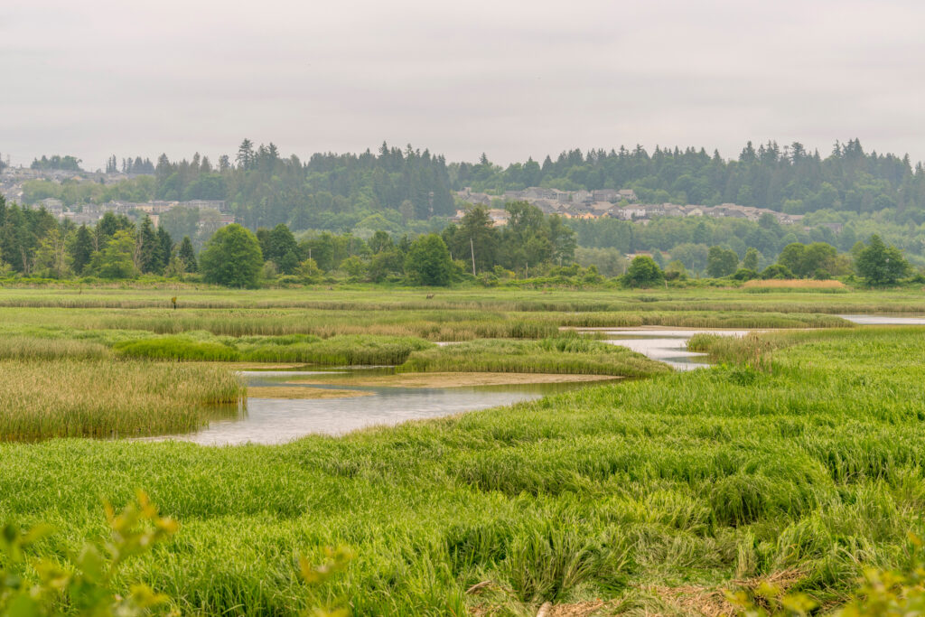
This is where the invisible becomes critical. Wetlands provide flood protection, build drought resilience, and promote biodiversity—functions that will only become more valuable as climate disasters intensify. Yet the National Wetlands Inventory, considered the gold standard for wetland mapping in the United States, was created in the 1970s using aerial imagery analyzed by hand. The inventory's fundamental limitation is simple: if human eyes can't see it in a photograph, it doesn't get mapped. In western Washington, the dense tree canopies fed by nine months of drizzle obscure wetlands from view. In eastern Washington, the naturally smaller wetlands can disappear entirely during dry seasons, making their seasonal patterns nearly impossible to detect from above.
Since 2018, Halabisky and Miller have collaborated with a network of local and federal partners—including the Washington Department of Ecology, the EPA, the National Science Foundation, and NASA—to develop a semi-automated AI tool that can detect what they call "cryptic wetlands." The tool uses machine learning and virtual watershed modeling to identify water bodies that conventional methods overlook, working at a scale and speed that human mappers cannot match. What makes this approach particularly significant is that it serves broader interests beyond pure conservation. The AI tool can help agricultural operations and housing developers work around wetlands rather than destroy them, creating a shared incentive structure where protection aligns with practical land management.
Amy Yahnke, senior wetlands scientist at the Washington Department of Ecology, articulated the core challenge: scientists needed "a better way to identify wetlands in forested areas," where many water bodies could lose federal protections before they are even identified. In Washington, where climate patterns, topography, and tree density create conditions that render wetlands nearly invisible to traditional methods, AI offers something more than technological novelty—it offers a lifeline. As federal guardrails weaken, local scientists are building their own tools to ensure that the state's hidden waters don't vanish before anyone knows they were there.