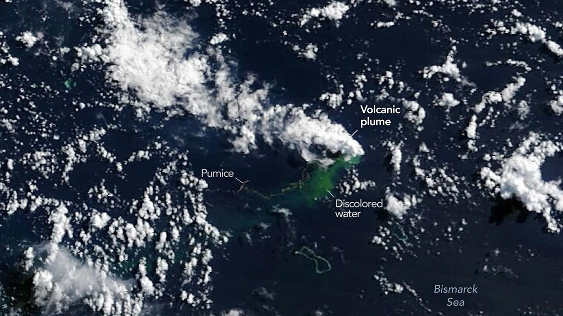
Far beneath the waves north of Papua New Guinea, something powerful is stirring. On May 8, 2026, NASA satellites picked up signs of an underwater volcanic eruption in the Central Bismarck Sea — and scientists are now watching to see if a brand-new island might emerge from the ocean. The eruption is occurring along a feature called Titan Ridge, roughly 16 kilometers (about 10 miles) southeast of where another underwater volcano erupted in 1972. What makes this moment especially exciting? Scientists have rarely been able to witness an island being born from space in real time.
Satellites spotted the eruption's first clues weeks ago. Seismometers recorded a cluster of small earthquakes on May 8, and by May 9, NASA's Aqua and Terra satellites were capturing images of white steam plumes rising through the atmosphere. The PACE satellite, which monitors ocean color, detected large patches of disturbed and discolored water around the eruption site. Other satellites then tracked ash plumes climbing several kilometers into the sky, and by May 12, instruments aboard the Suomi NPP satellite identified thermal anomalies — areas of unusual heat — covering about seven square kilometers.
The discovery is revealing how little we still know about the ocean floor. The Bismarck Sea contains faults, volcanic ridges, and active zones where the Earth's crust pulls apart, but much of it sits at depths too great for detailed sonar mapping. "There must be a lot of hot material near the surface to generate so many thermal anomalies," said Simon Carn, a volcanologist at Michigan Tech. "This suggests a fairly shallow eruption vent — much shallower than what's implied by the existing bathymetry, which shows water depths of several hundred meters or more."
That said, scientists do not expect this eruption to become extremely violent. Unlike the dramatic 2022 Hunga Tonga-Hunga Ha'apai eruption, which shattered records worldwide, this event is happening along a spreading center — a zone where the seafloor pulls apart rather than collides. "Spreading centers are associated with less explosive activity," Carn explained. "The most explosive eruptions are usually along subduction zones." Still, researchers cannot predict exactly how long this eruption will last. One nearby underwater eruption in 1972 ran for just four days, while another event in 1957 continued for nearly four years.
The big question now is whether solid land will break through the surface. Satellite images already show massive rafts of pumice — lightweight volcanic rock that floats — drifting with ocean currents. "We're now eagerly waiting to see if a new island is about to be born — something that we've only rarely been able to observe with satellites as it happens," said Jim Garvin, chief scientist at NASA's Goddard Space Flight Center. If land does appear, Garvin plans to use radar data from the NASA-ISRO NISAR satellite to map its shape and track how it changes over time.
If a permanent island forms, it could become an extraordinary natural laboratory — a place where scientists, what Garvin calls "island-auts," could study how plants and animals gradually colonize brand-new land. For now, researchers around the world are watching and waiting.